Le Petit Versailles
Location: Le Petit Versailles, Vacherie, St. James Parish, Louisiana
Date: 2024-09-24
Team: Brendan Harmon
Equipment: DJI Matrice 300 RTK with L1 Lidar
Spatial Reference System: WGS 84 / UTM zone 15N (EPSG: 32615)
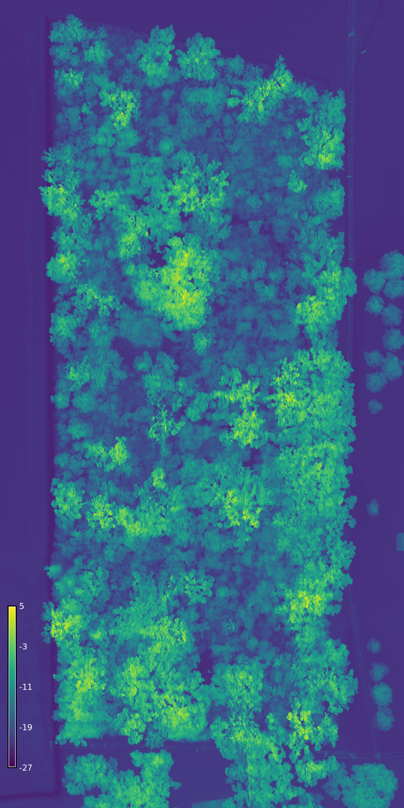
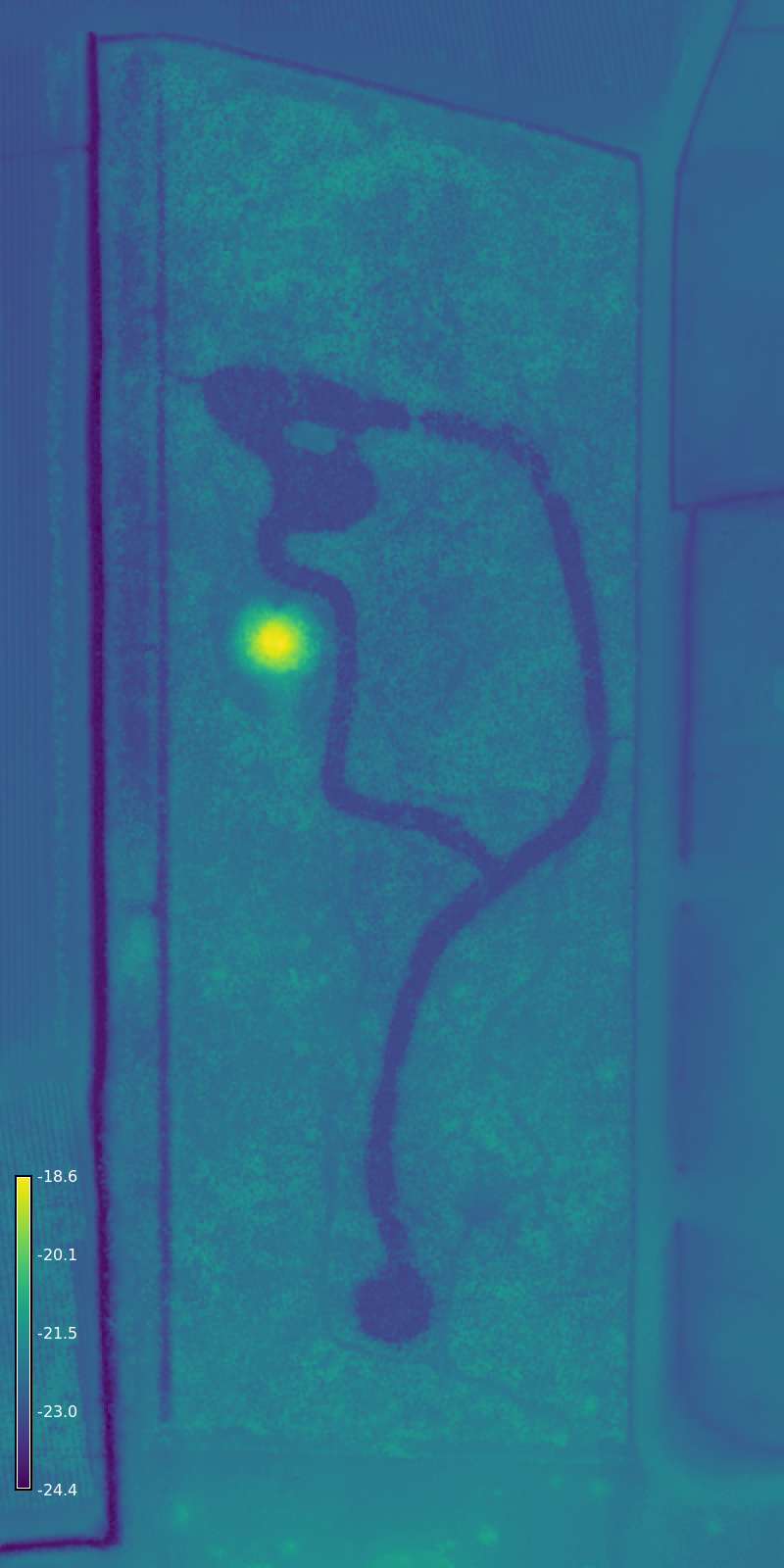
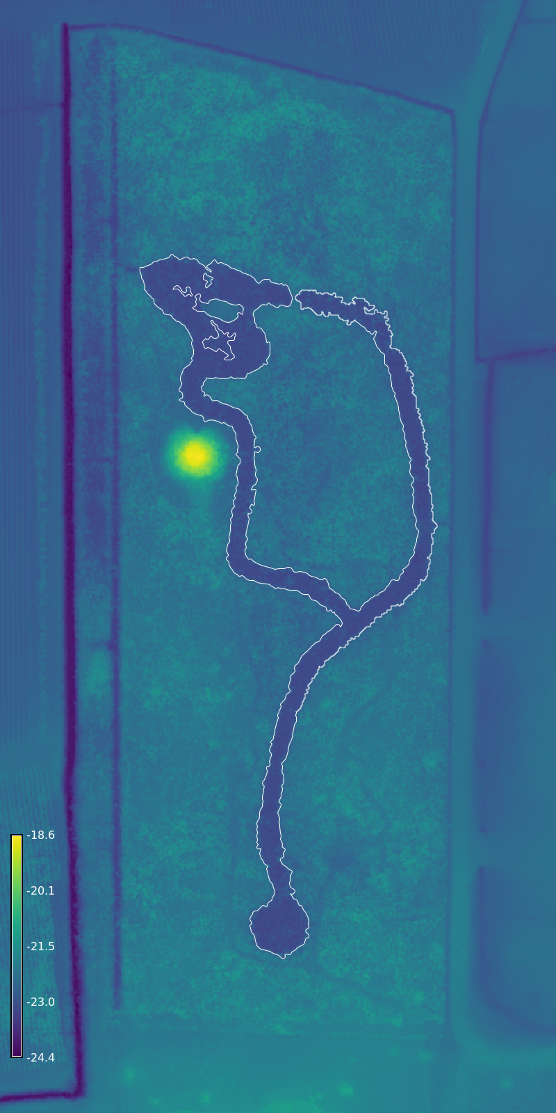
This drone lidar dataset documents the lost 19th century pleasure garden of Valcour Aime. Long abandoned, the ruins of the garden are enveloped by dense overgrowth and a canopy of mature southern live oaks. The lidar survey reveals traces of the garden such as the historic canals and artificial mountain. The lidar data was processed and analyzed using the GRASS Geocomputation Engine in a computational notebook. This dataset includes a lidar point cloud, a digital elevation model, a digital surface model, and a vector map of the historic canals. This project was supported by the LSU Center for GeoInformatics. The data are released under the Creative Commons Zero public domain dedication.
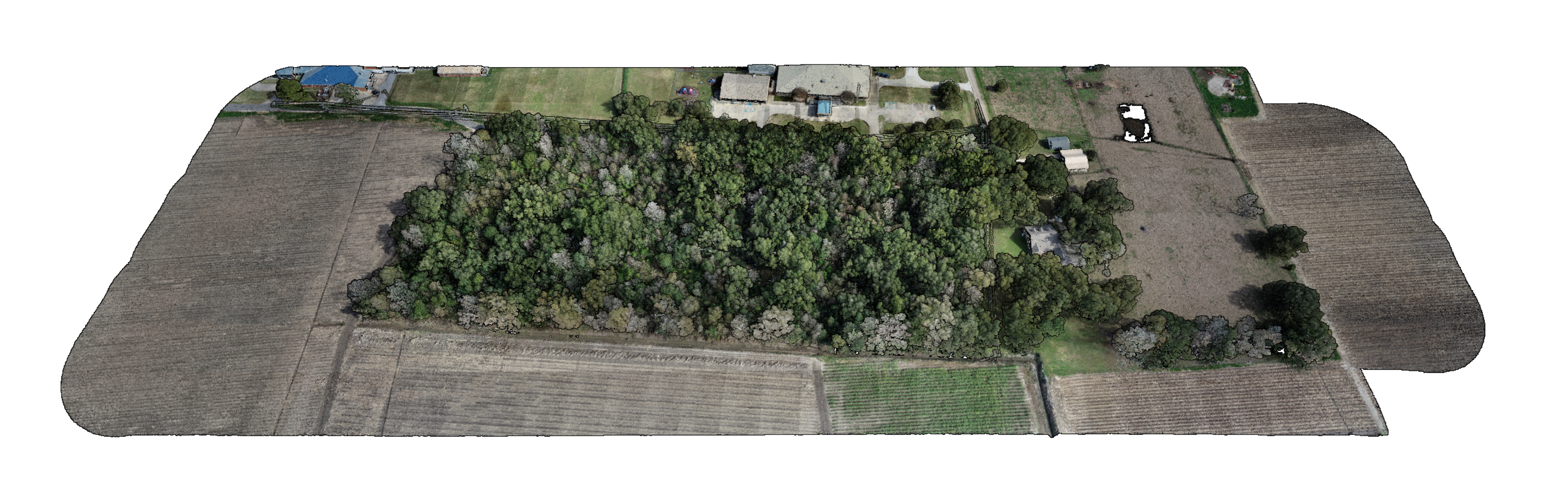 Lidar point cloud with true color
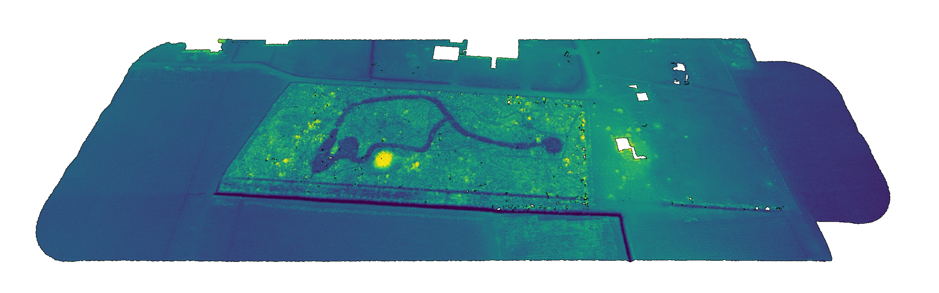 Bare ground point cloud with hypsometric tinting
Data
Point Cloud Viewer: Lidar 2024
Point Cloud: petit-versailles.laz
Surface Raster: petit-versailles-surface.tif
Elevation Raster: petit-versailles-elevation.tif
Contours: petit-versailles-contours.geojson
Canal: petit-versailles-feature.geojson
Features: petit-versailles-features.geojson
| Surface | Elevation | Canal |
|---|---|---|
 |
 |
 |
Citing
Please cite as:
Harmon, B. (2026). Le Petit Versailles Dataset (1.0.0) [Data set]. Zenodo. https://doi.org/10.5281/zenodo.19154246
Bibtex:
@dataset{harmon_2026_19154246,
  title     = {Le Petit Versailles Dataset},
  author    = {Harmon, Brendan},
  year      = 2026,
  publisher = {Zenodo},
  doi       = {10.5281/zenodo.19154246},
  url       = {https://doi.org/10.5281/zenodo.19154246},
  version   = {1.0.0}
}