Point Cloud Repository
Welcome to the XYZ Point Cloud Repository, a collection of point clouds from laser scanning, photogrammetry, and neural renderings by Louisiana State University’s College of Art and Design.
Team Leadership: Annicia Streete, Brendan Harmon, and Nicholas Serrano.
Team: Joseph Brooks, Carlos Roman, Cecil Chapman, Caroline Robertson, Christos Baos, Graham Hargis, etc.
Equipment: DJI Matrice 300 RTK with L1 Lidar
Funding: National Park Service Preservation Technology and Training Grant & Architecture Research Centers Consortium’s Research Incentive Award
Report: https://doi.org/10.5281/zenodo.18009933
Dataset: https://doi.org/10.5281/zenodo.18819013
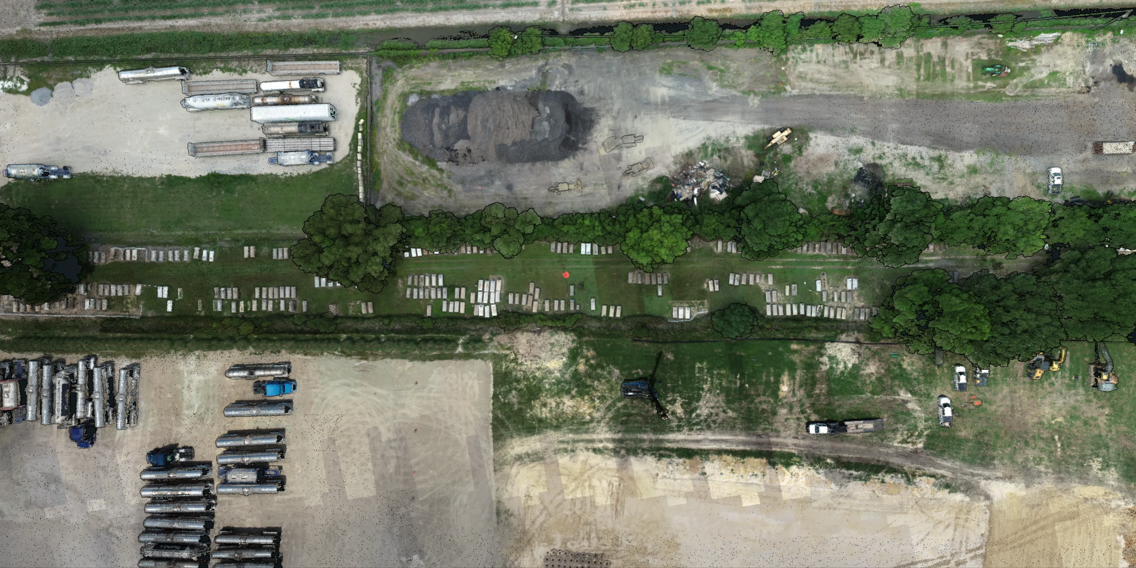
African American Burial Grounds This project aims to document African American burial grounds in the Louisiana River Parishes. The Louisiana River Parishes are scattered with hundreds of African American cemeteries dating back to the antebellum period when plantations lined both sides of the Mississippi River. This history of environmental racism continued into the 20th century as the region was favored for hazardous petrochemical production facilities. Today these cultural landscapes are threatened by industrial expansion, climate change, missing land-tenure records, and dwindling populations of descendant communities. Our team is 3D scanning burial grounds and compiling a database of interactive, publicly accessible digital models to preserve the record of these cultural landscapes. The project leads are Annicia Streete, Brendan Harmon, and Nicholas Serrano. This research is funded by a National Park Service Preservation Technology and Training Grant. This project is supported by the LSU Center for GeoInformatics and the LSU Coastal Ecosystem Design Studio. The point clouds are released under the Creative Commons Zero public domain dedication.
Alford Lidar 2023:
point cloud viewer
+
point cloud data
Alford Lidar 2024:
point cloud viewer
+
point cloud data
Alford Tomb I:
splat viewer
+
point cloud viewer
Alford Tomb II:
splat viewer
+
point cloud viewer
Alford Tomb III:
splat viewer
+
point cloud viewer
Alford Tomb IV:
splat viewer
+
point cloud viewer
Alford Tomb V:
splat viewer
+
point cloud viewer
Alford Tomb VI:
splat viewer
+
point cloud viewer
Alma Lidar 2024:
point cloud viewer
+
point cloud data
Ashland Lidar 2024:
point cloud viewer
+
point cloud data
Chamberlin Lidar 2024:
point cloud viewer
+
point cloud data
Lady of Knight Lidar 2024:
point cloud viewer
+
point cloud data
Mt. Zion Riverlake Lidar 2024:
point cloud viewer
+
point cloud data
Mulatto Bend Lidar 2024:
point cloud viewer
+
point cloud data
Silvery Lidar 2024:
point cloud viewer
+
point cloud data
St. Catherine Lidar 2024:
point cloud viewer
+
point cloud data
United Benevolent Society Lidar 2024:
point cloud viewer
+
point cloud data
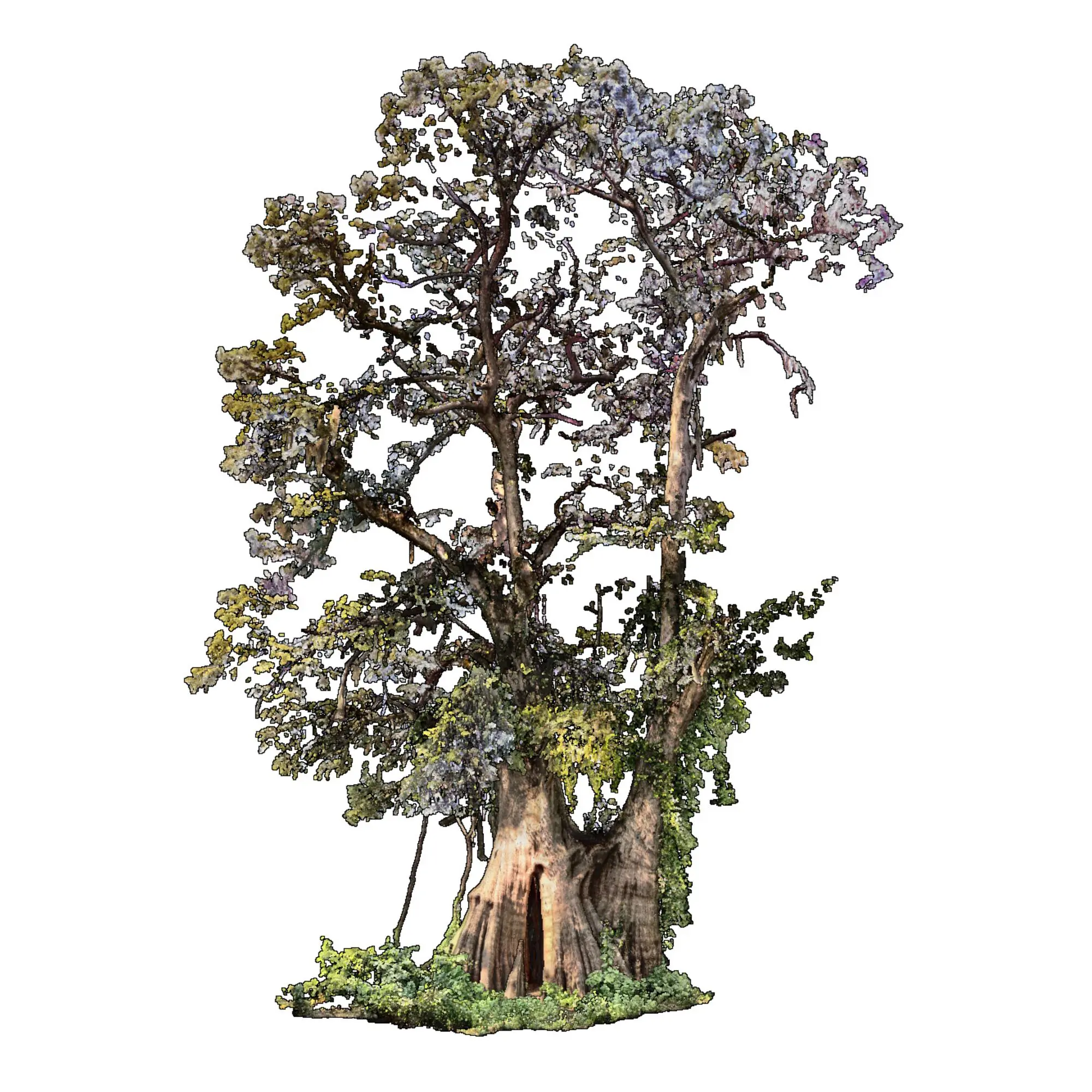
The Atlas of Heritage Trees
is an archive of ancient trees
of exceptional historical, cultural, and ecological significance.
The trees, captured using terrestrial laser scanning and drone lidar,
have been archived in
laz, e57, pcd, xyz, and 3dm format point clouds.
The project leads are Brendan Harmon
and Hye Yeon Nam.
Contributors include
Javier Zamora,
Huan Guo,
Carlos Roman,
Joseph Brooks,
Cecil Chapman,
Sebastian Crandall,
William Reinhardt,
Julie Whitbeck,
Kaiti Fink,
and Jeff Boucher.
This project was funded by the
LSU Big Ideas Grant and the
LSU Arts & Humanities Support Fund.
It was supported by the LSU Center for GeoInformatics
and the LSU Coastal Ecosystem Design Studio.
The point clouds are released under the
Creative Commons Zero
public domain dedication.
10.5281/zenodo.8353292
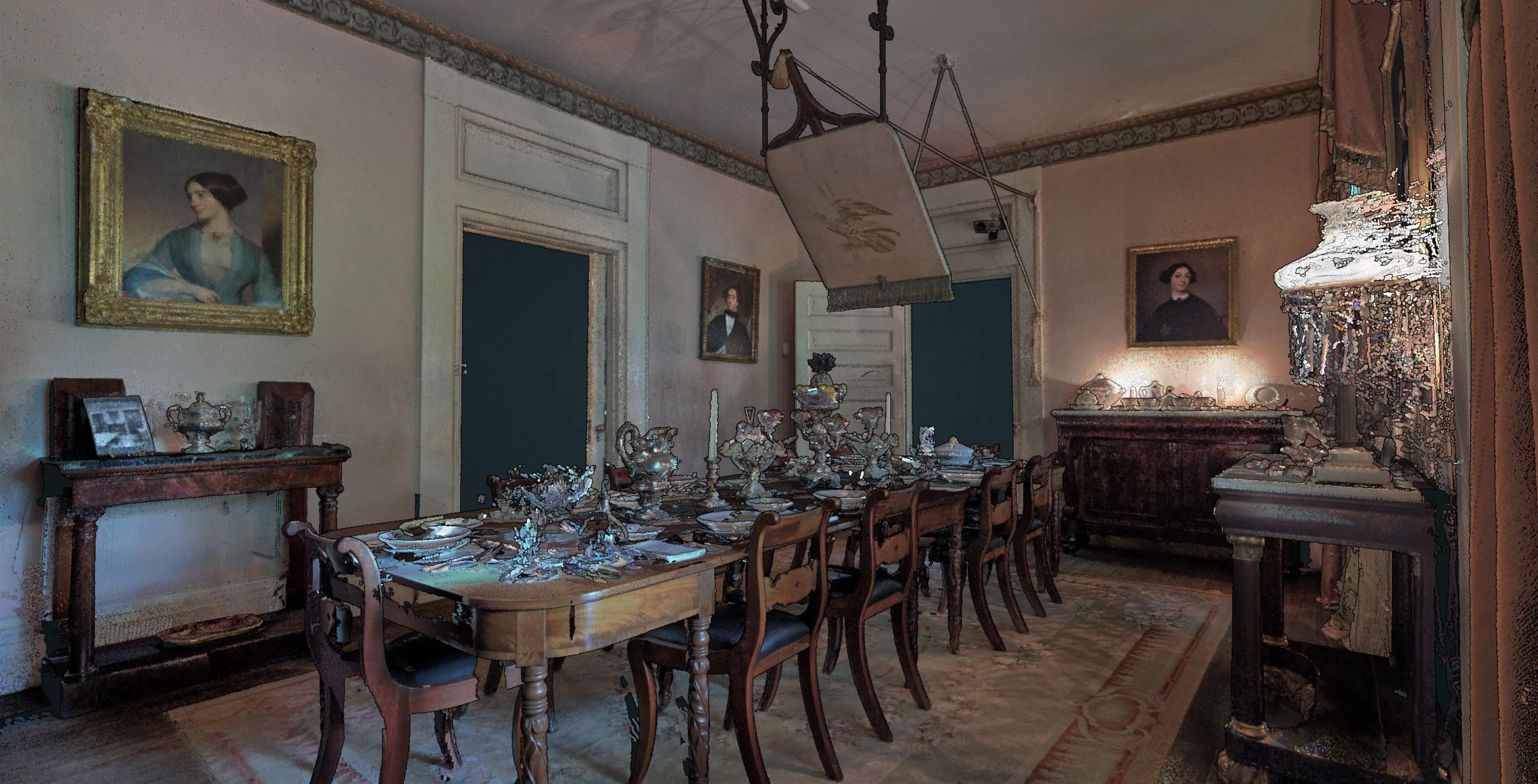
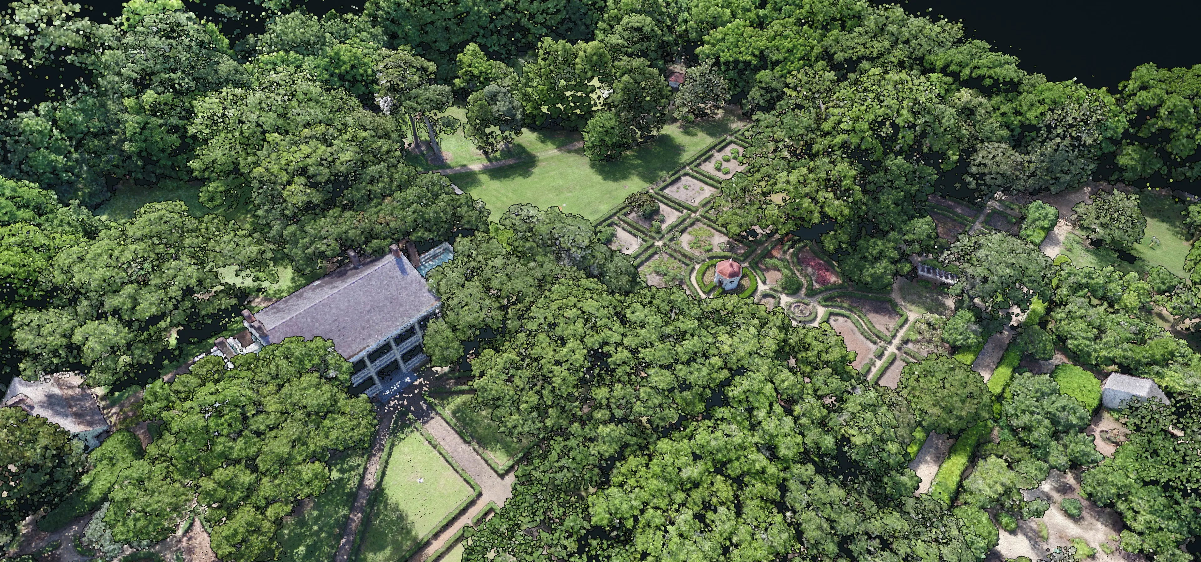
Rosedown is a two hundred acre site in St. Francisville, Louisiana with the well preserved remains of an antebellum plantation dating from 1834 including the main house, ancillary buildings, and formal gardens. The point cloud of Rosedown was created using terrestrial laser scanning with a Faro Focus and drone photogrammetry with a DJI Matrice 600 Pro with Zenmuse X5 camera. The project was lead by Brendan Harmon and Nicholas Serrano. The team included Josef Horacek, Sasha Matthieu, William Conrad, Javier Zamora, Matthew Cranney, and Ming Li. This project was supported by the LSU Center for GeoInformatics and LSU Coastal Sustainability Studio and funded by the National Park Service’s Historic Preservation Fund. The datasets are licensed Creative Commons Zero.
Rosedown Point Cloud Viewer
The model of Rosedown is composed of many separate point clouds, each recording an important element of the plantation. This point cloud viewer presents the collection as an ensemble that can be explored by toggling on or off layers. Open the viewer, expand its menu, then expand the scene tab, and turn on or off point cloud layers.
Point Cloud Datasets
Location: Hilltop Arboretum, Baton Rouge, Louisiana
Team: Brendan Harmon, Josef Horacek, Dan Cooke, & Matthew Cranney
Equipment: FireFLY Pro 6 with MicaSense RedEdge-M sensor
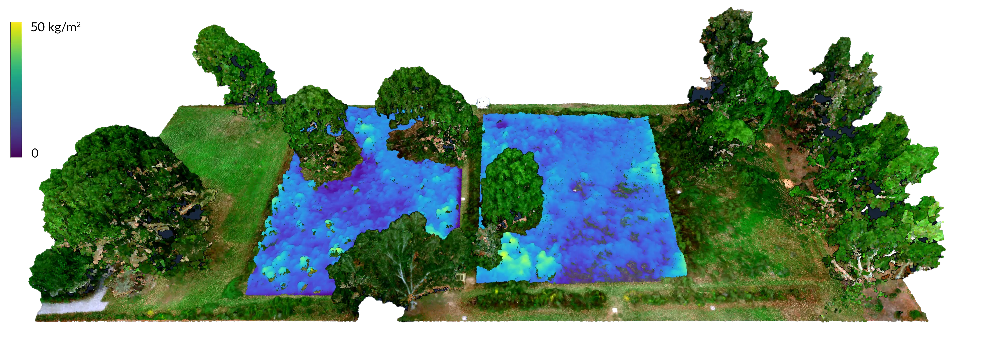
Hilltop Photogrammetry A Cajun Prairie Wildflower Meadow was established in 2020 at the LSU Hilltop Arboretum in Baton Rouge, Louisiana. Five fields have been restored as coastal tallgrass prairie, a highly endangered ecosystem of which only one percent remains intact. The evolution of the newly established meadow was recorded with a series of monthly aerial surveys by a drone with a multispectral sensor. Net annual biomass and carbon were computed from the time series of point clouds. The team lead for this project was Brendan Harmon. The team included Josef Horacek, Dan Cooke, and Matthew Cranney. The surveys were conducted with a FireFLY Pro 6 fixed wing drone with a MicaSense RedEdge-M sensor and 9 permanent ground control points. This project was supported by the LSU Center for GeoInformatics. The datasets are licensed Creative Commons Zero.
Point Cloud Time Series Viewers
Explore the time series of point clouds with Potree by expanding the point cloud viewer’s menu, expanding the scene tab, and turning on or off point cloud layers.
Point Cloud Datasets
Location: Hilltop Arboretum, Baton Rouge, Louisiana
Team: Brendan Harmon
Equipment: DJI Matrice 300 RTK with L1 Lidar
Hilltop Lidar From 2022 onwards the meadow is being surveyed annually using a drone with lidar. The ongoing surveys are conducted with a DJI Matrice 300 RTK drone with an L1 lidar sensor. This project is supported by the LSU Center for GeoInformatics. The datasets are licensed Creative Commons Zero.

Avery Island Buddha A laser scan of the Buddha in the Jungle Gardens on Avery Island in Louisiana by Brendan Harmon and William Ma. The point cloud is licensed Creative Commons Zero.
Point Cloud Viewer & Dataset
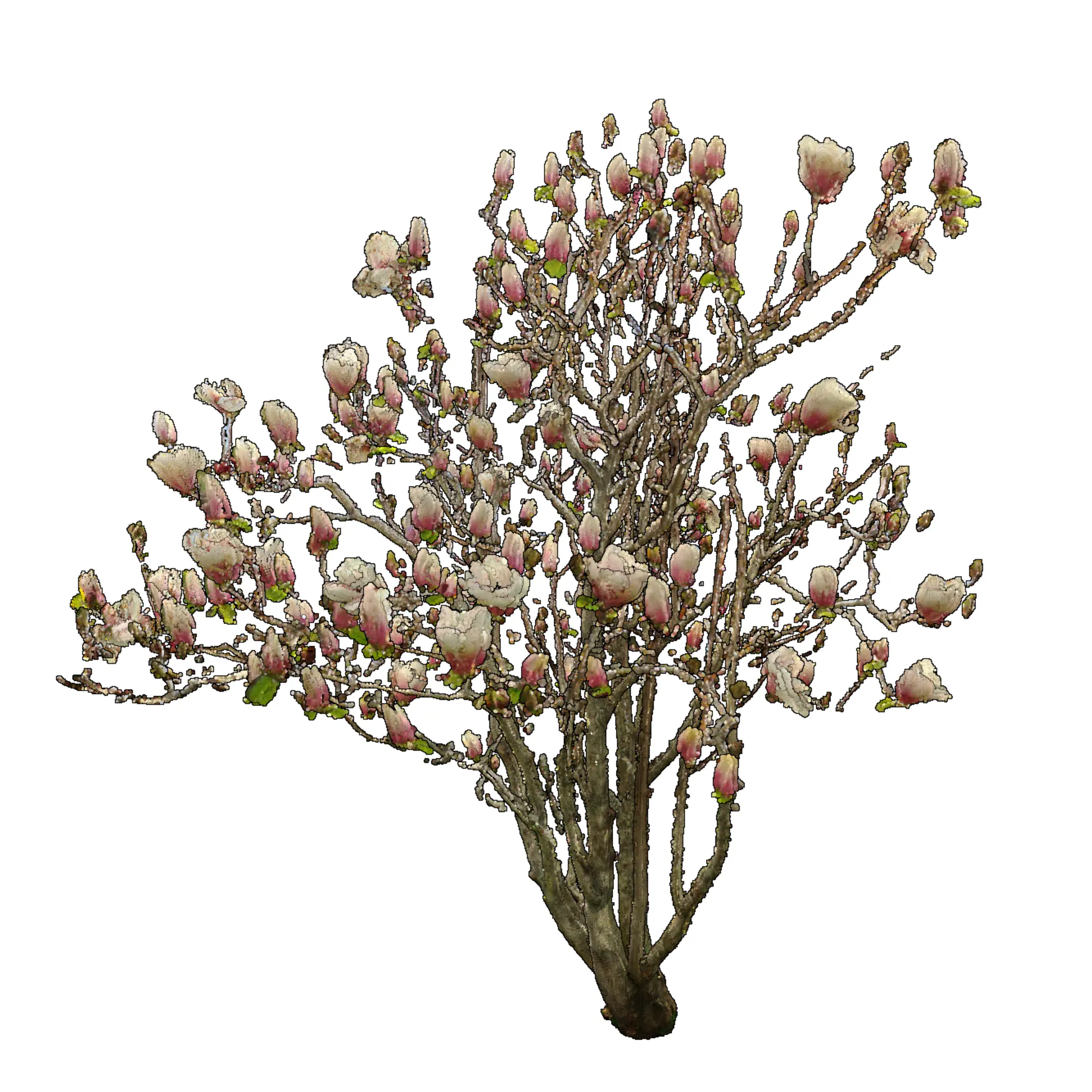
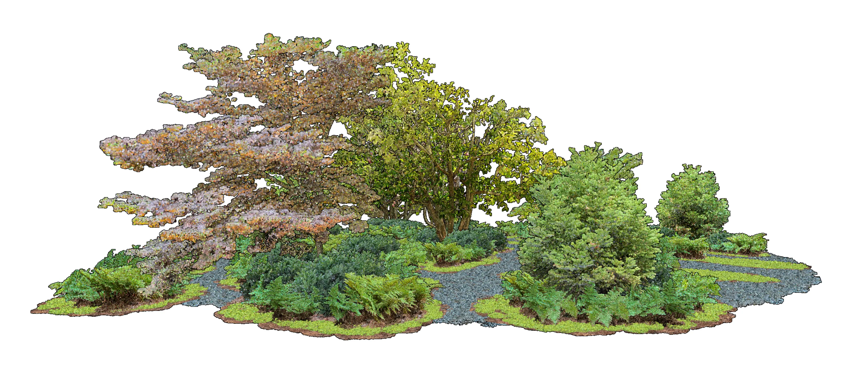
Cloud Forest
is a point cloud collection
of trees, shrubs, herbaceous plants, and other landscape elements.
Each specimen is available as
laz, e57, pcd, ply, xyz, and 3dm format point clouds.
The project lead is Brendan Harmon.
The project team includes
Javier Zamora, Huan Guo, Jacob Contreras, and Ryan Antoon.
The point clouds are released under the
Creative Commons Zero
public domain dedication.
10.5281/zenodo.8194067
| Common Name | Latin Name | No. |
|---|---|---|
| Japanese Maple | Acer palmatum | 1 |
| Japanese Maple | Acer palmatum | 2 |
| Desert Rose | Adenium obesum | 1 |
| Japanese Plum Yew | Cephalotaxus harringtonia | 1 |
| Japanese Cedar | Cryptomeria japonica | 1 |
| Autumn Fern | Dryopteris erythrosora | 1 |
| Autumn Fern | Dryopteris erythrosora | 2 |
| Autumn Fern | Dryopteris erythrosora | 3 |
| Autumn Fern | Dryopteris erythrosora | 4 |
| Blanketflower | Gaillardia aristata | 1 |
| Hodge Podge | 1 | |
| Bearded Iris | Iris x germanica | 1 |
| Bearded Iris | Iris x germanica | 2 |
| Bearded Iris | Iris x germanica | 3 |
| Bearded Iris | Iris x germanica | 4 |
| Bearded Iris | Iris x germanica | 5 |
| Bay Laurel | Laurus nobilis | 1 |
| Saucer Magnolia | Magnolia soulangeana | 1 |
| Saucer Magnolia | Magnolia soulangeana | 2 |
| Wax Myrtle | Morella californica | 1 |
| Walking Iris | Neomarica caerulea | 1 |
| Pebble | 1 | |
| Pebble | 2 | |
| American Sycamore | Platanus occidentalis | 1 |
| Christmas Fern | Polystichum acrostichoides | 1 |
| Cherry Laurel | Prunus laurocerasus | 1 |
| Cherry Laurel | Prunus laurocerasus | 2 |
| White Oak | Quercus alba | 1 |
| Christmas Cactus | Schlumbergera bridgesii | 1 |
| Christmas Cactus | Schlumbergera bridgesii | 2 |
| Lamb’s Ear | Stachys byzantina | 1 |
Cloud Garden is a computational design for a garden generated from procedural noise and modeled as a point cloud. All of the plants in the garden are either laser scanned or neural rendered specimens collected in the wild.
Team: Brendan Harmon
Date: June 15, 2025
Medium: Point cloud
License: Creative Commons Zero
Location: Le Petit Versailles, Vacherie, St. James Parish, Louisiana
Date: 2024-09-24
Team: Brendan Harmon
Equipment: DJI Matrice 300 RTK with L1 Lidar
Spatial Reference System: WGS 84 / UTM zone 15N (EPSG: 32615)
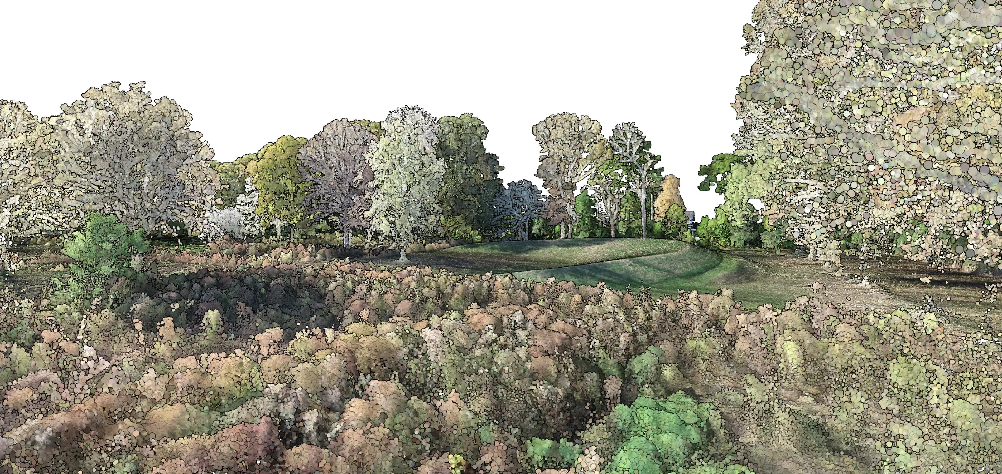
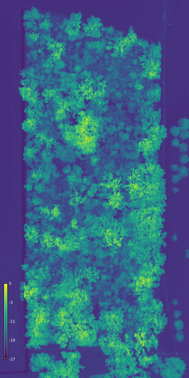
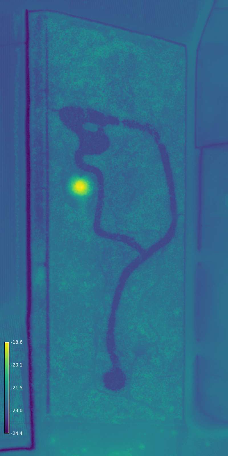
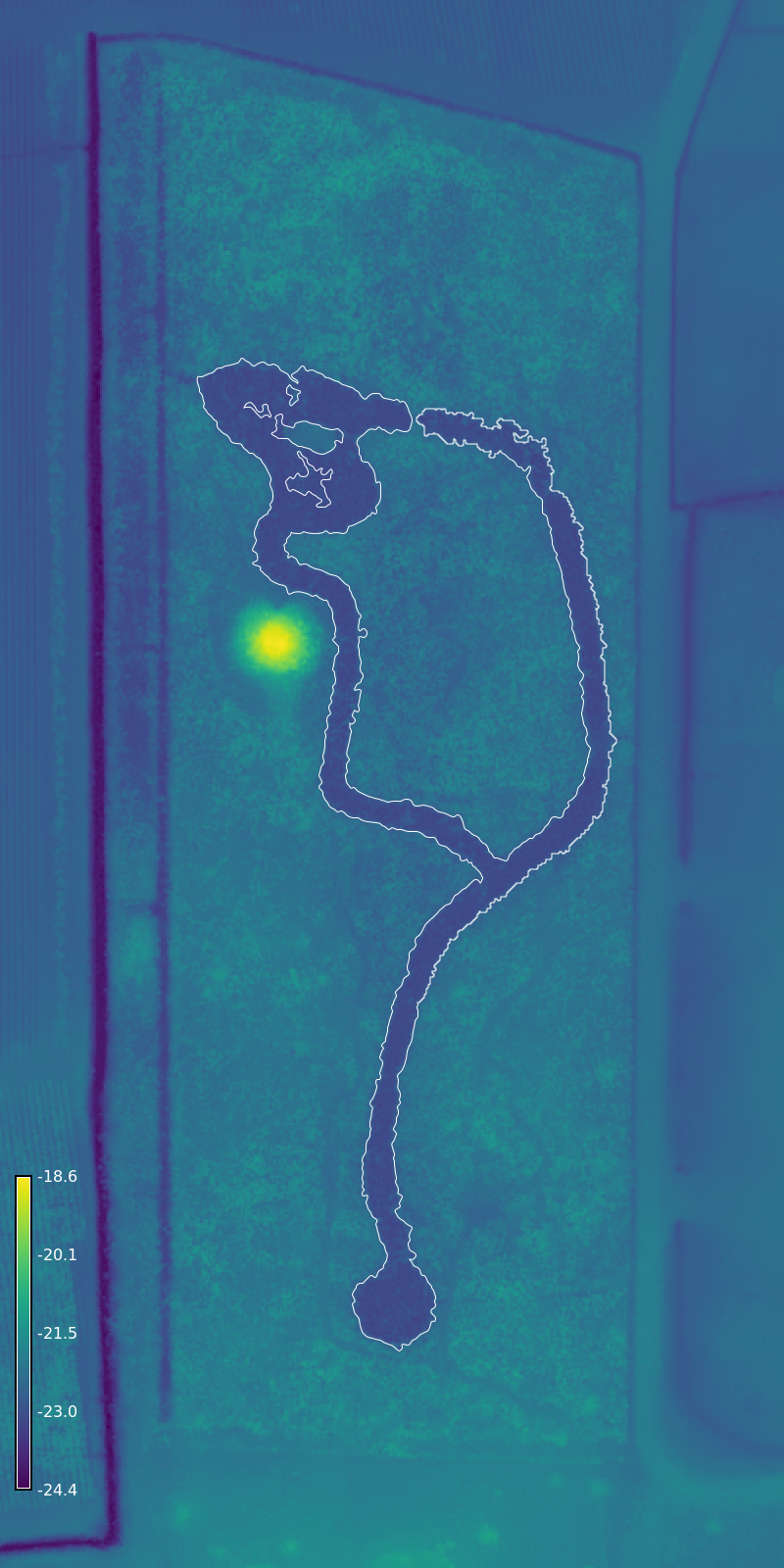
Le Petit Versailles This drone lidar dataset documents the lost 19th century pleasure garden of Valcour Aime. Long abandoned, the ruins of the garden are enveloped by dense overgrowth and a canopy of mature southern live oaks. The lidar survey reveals traces of the garden such as the historic canals and artificial mountain. The lidar data was processed and analyzed using the GRASS Geocomputation Engine in a computational notebook. This dataset includes a lidar point cloud, a digital elevation model, a digital surface model, and a vector map of the historic canals. This project was supported by the LSU Center for GeoInformatics. The data are released under the Creative Commons Zero public domain dedication.
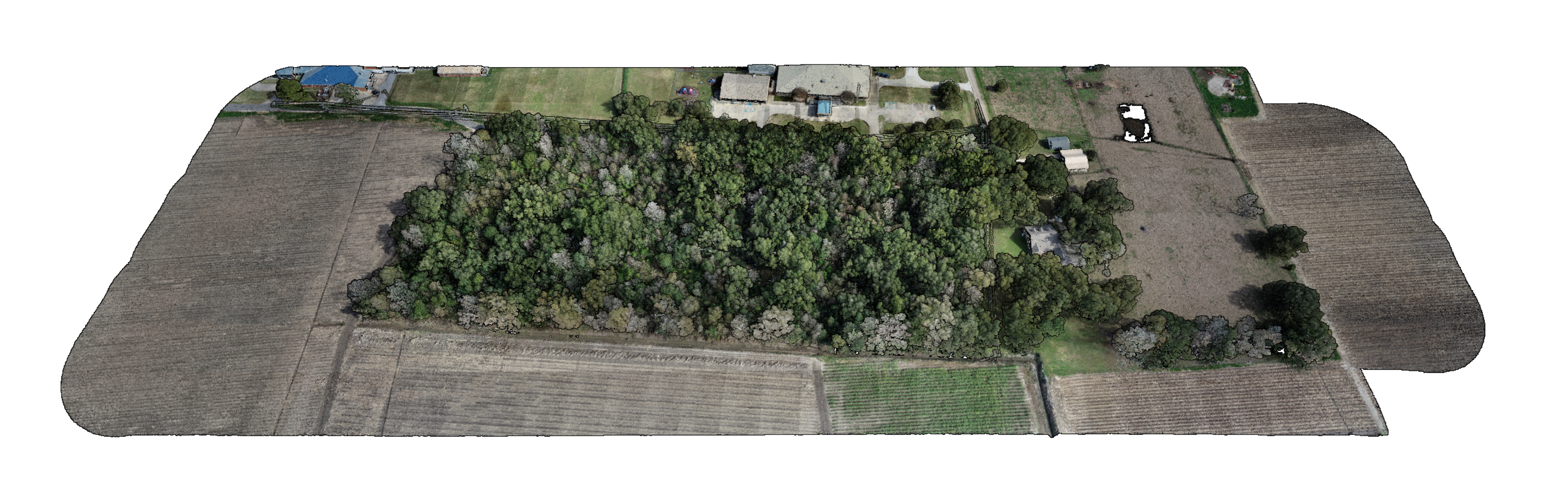 Lidar point cloud with true color
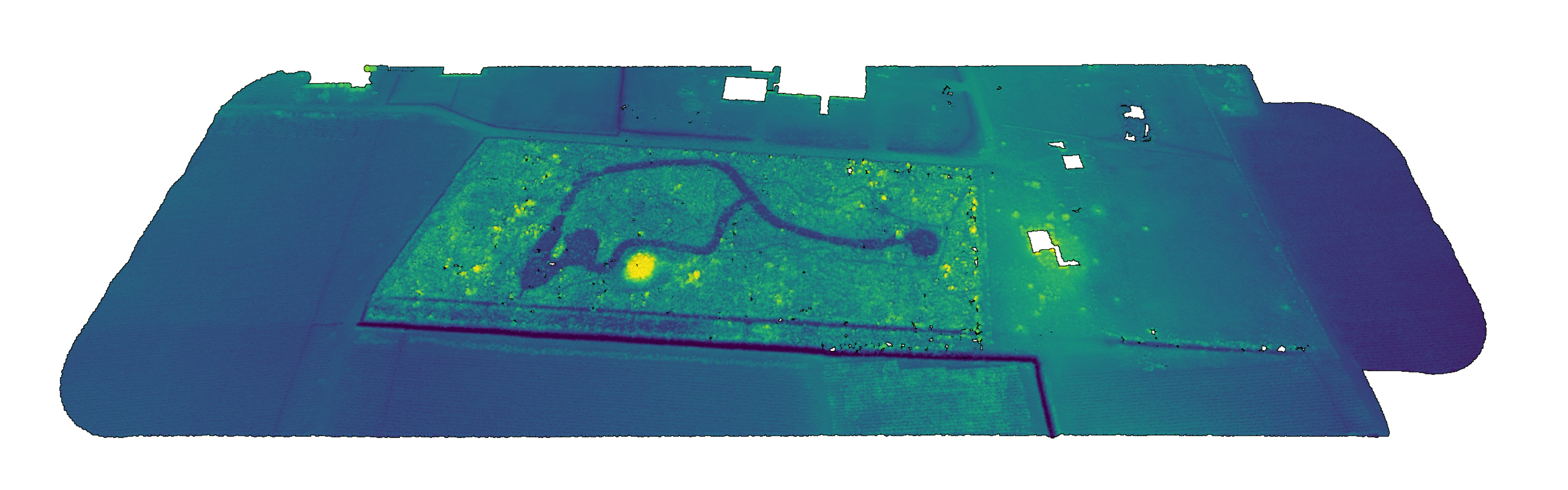 Bare ground point cloud with hypsometric tinting
Data
Point Cloud Viewer: Lidar 2024
Point Cloud: petit-versailles.laz
Surface Raster: petit-versailles-surface.tif
Elevation Raster: petit-versailles-elevation.tif
Contours: petit-versailles-contours.geojson
Canal: petit-versailles-feature.geojson
Features: petit-versailles-features.geojson
| Surface | Elevation | Canal |
|---|---|---|
 |
 |
 |
Citing
Please cite as:
Harmon, B. (2026). Le Petit Versailles Dataset (1.0.0) [Data set]. Zenodo. https://doi.org/10.5281/zenodo.19154246
Bibtex:
@dataset{harmon_2026_19154246,
  title     = {Le Petit Versailles Dataset},
  author    = {Harmon, Brendan},
  year      = 2026,
  publisher = {Zenodo},
  doi       = {10.5281/zenodo.19154246},
  url       = {https://doi.org/10.5281/zenodo.19154246},
  version   = {1.0.0}
}